It's more than a map... It's GIS!
Connecting your information data with geospatial technlogy can provide greater understanding and insights that will help you improve planning and accountability.

Connecting your information data with geospatial technlogy can provide greater understanding and insights that will help you improve planning and accountability.
Lower your GIS cost - Expand your GIS capabilities
When you need to develop a plan; know what assets you have and where they are; or need to make important decisions, you need quick access to information. GIS connects spatial information with tabular data and imagery to help you make better decisions.
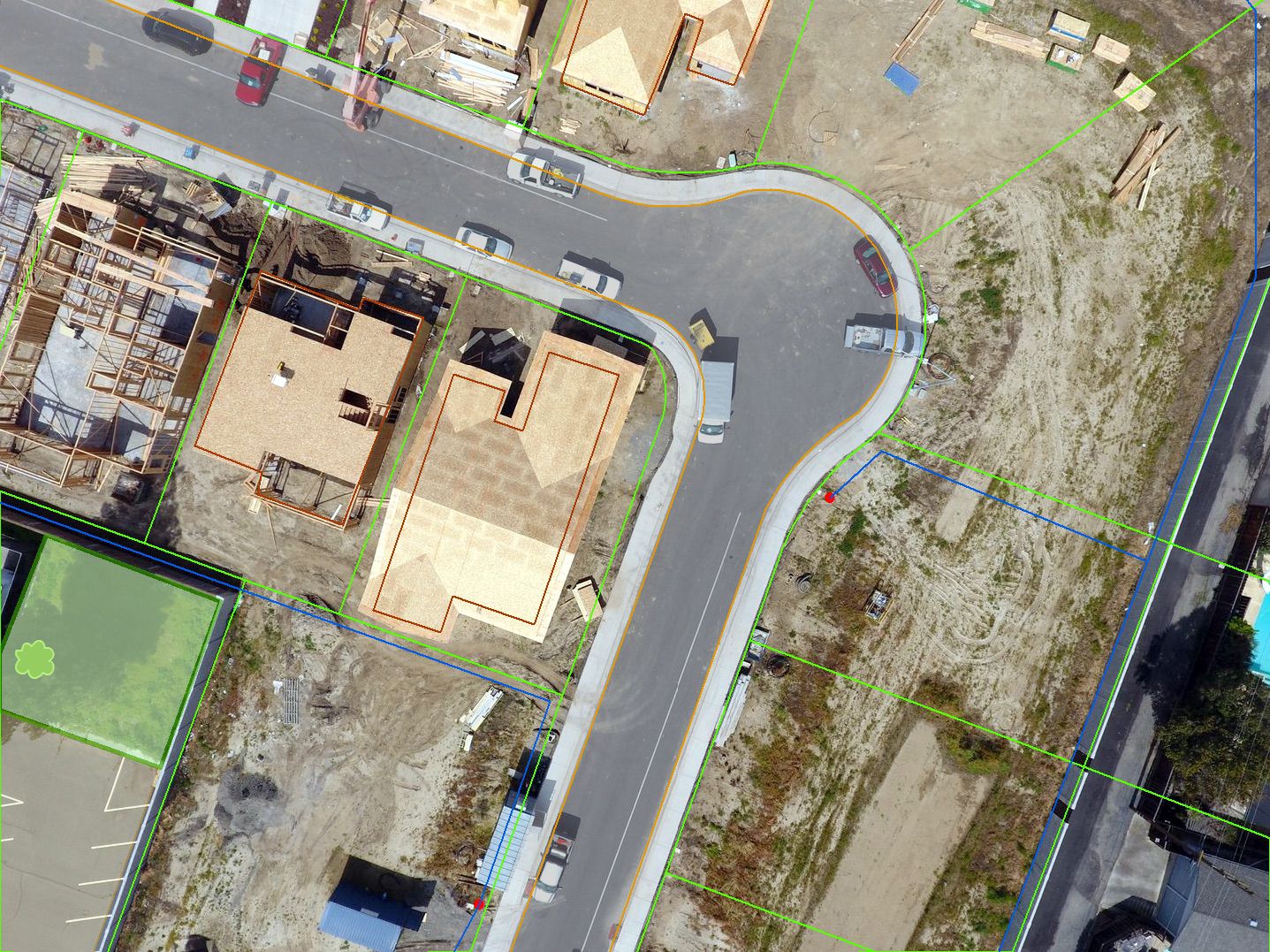
Data is the foundation of any system, especially GIS. It is often cited that 80% of data has a location component, and that 80% of the effort in implementing GIS is data creation and gathering.
Drawing a map is the easy part, the power of GIS is the ability to identify relationships and patterns through spatial analysis and remote sensing techniques.
Learning how to use your GIS software with the help of a good instructor will greatly improve your ability do more quicker and get more from your software.

The geospatial industry continues to expand at a rapid rate. A good consultant can help you understand what is possible and help you get the most from your investment.
Learn more about this course and our other trainng offerings:
Geographic Information System (GIS) is a system composed of Data, Software, Hardware, Methods, and People.
GIS technology provides all industries with powerful location analysis and visualization capabilities.
Geography is the study of the physical features of the earth and its atmosphere, and of human activity as it affects and is affected by these, including the distribution of populations and resources, land use, and industries. It is an area of study that impacts everyone because daily we make many decisions based on geography such as:
- where something is;
- how to get to a location;
- what is around a location;
- is there a pattern in events;
- and more...
Knowing where features or events are located geographically is important to many of our decision making processes. Displaying information on maps allows us to determine additional spatial information, such as their proximity to other features or events, and see patterns that may indicate trends or relationships. Being able to make these spatial connections provides very useful and insightful information that we can use to make important and sound decisions. Connecting information and geography gives us a powerful decision making tool.
GIS is a tool that helps you answer these questions.
FOLLOW US